How Green Are We?
In this project, we, Daniel Speck and Zeynep Seda Birinci, two students from the Intelligent Adaptive Systems Master's program of the University of Hamburg, are working on the long-term effects of global warming w.r.t. tree development to assess how “green” we are and in which direction the development is heading. Thus, our objective is to detect trees in Hamburg using artificial intelligence algorithms and evaluate which approaches are best to answer our research questions of “how green are we?”. We are conducting this study under the supervision of Prof. Dr. Stefan Wermter and Dr. Matthias Kerzel.
Our plan is using the GeoTIFF data format to train different detection models. This format is commonly used for aerial imagery and maintains the geolocation of 2D images, thus enabling us to detect trees in images and track them down to actual “real-world” coordinates. Amongst other data that we evaluate currently, we use a training dataset obtained from Ventura et al. (2022), which comprises 1,500 images and nearly 100,000 tree annotations, encompassing eight cities, six climate zones, and three years of image capture from Southern California since this was the largest annotated dataset we could find so far.
Upon completing our tree detection model training, we plan to apply it to aerial imagery of Hamburg in the GeoTIFF format. By processing 2D images using the model to detect the trees, and with the help of the GeoTIFF format, we will utilize the location information of these images to accurately identify the green areas of the city and their development (e.g. year to year comparison).
Currently, we are testing different architectures such as “point”-based, “bounding box”-based, and “segmentation” based detection models. We are evaluating state of the art algorithms for our object detection, e.g. YoloV8, which has demonstrated superior performance on detecting objects in real-time. By utilizing these algorithms in our approach, we aim to achieve a high accuracy in detecting trees in Hamburg.
Our project has the potential to provide valuable insights into the green areas of Hamburg and help urban planners and policymakers make informed decisions regarding the preservation and management of green spaces in the city.
Student Researchers
- Daniel Speck
- Zeynep Seda Birinci
Mentors
- Prof. Dr. Stefan Wermter
- Dr. Matthias Kerzel
Images
The Student Research Team
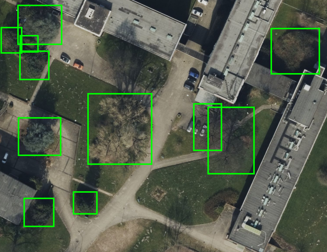
Aerial Imagery of Informatics Campus with Detections (University of Hamburg) - Image source: Apple Maps